Map of rivers and provinces
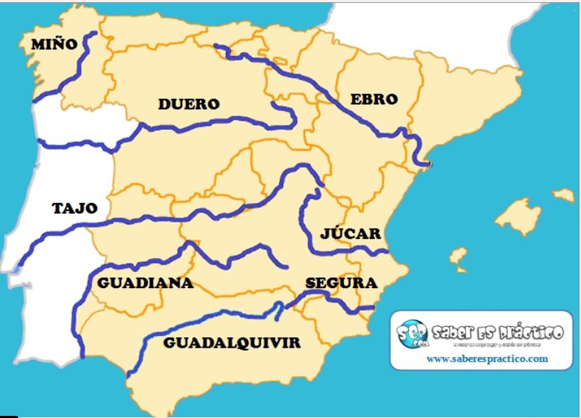
This map shows the main rivers of Spain. You have to know about them: their source, their mouth, and the provinces they cross.
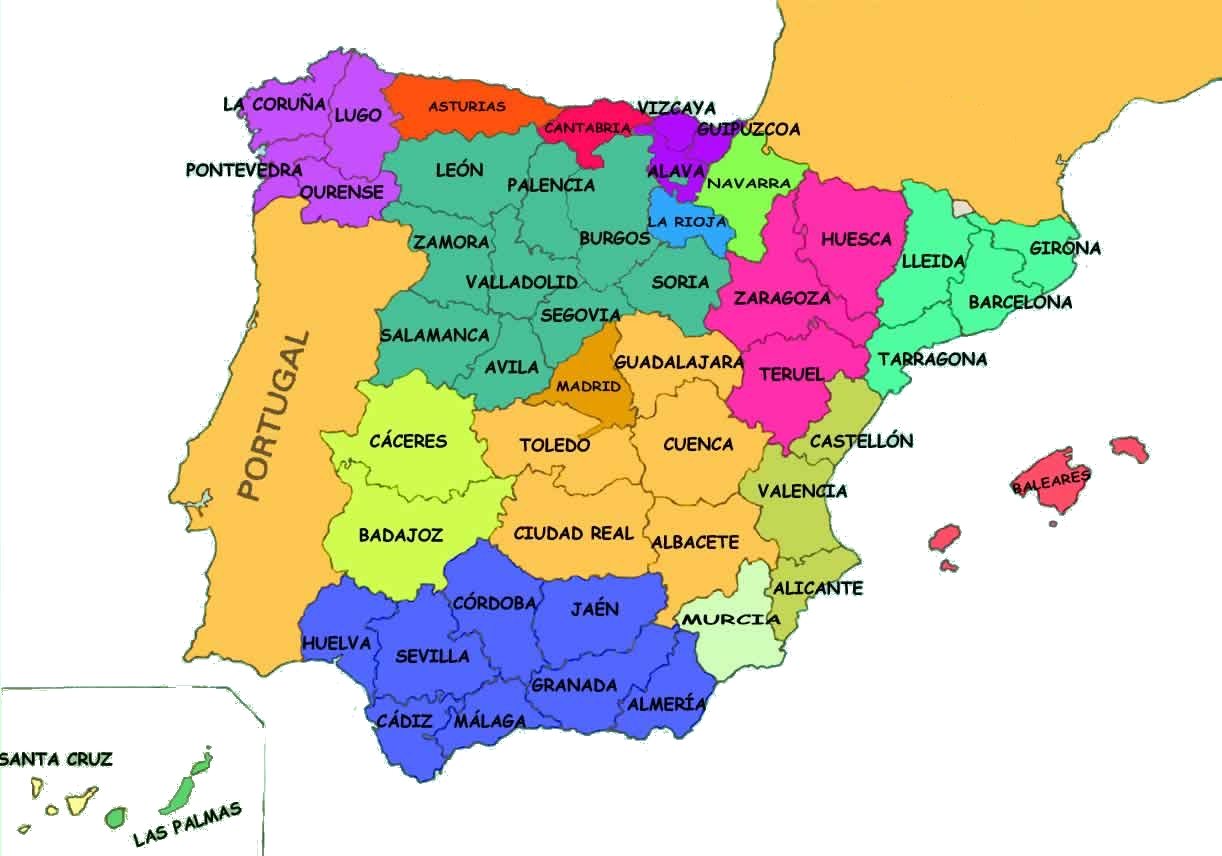
In this map you can also see the outlines of the autonomous communities. This can help you visualise the provinces.
No hay comentarios:
Publicar un comentario