Mostrando entradas con la etiqueta Europe. Mostrar todas las entradas

sábado, 13 de mayo de 2017

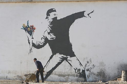
Banksy paints Brexit!

Who is Banksy?

He is a British street artist whose works appear in different locations around the world. His identity is a secret, so he must work quickly to avoid being discovered.

He uses stencils (plantillas) to create his art, which often has a message.  Here are a few of his most famous works:


On Monday, 8th of May, this Banksy mural appeared in Dover, near the ferry that connects the UK with France:

https://www.ft.com/__origami/service/image/v2/images/raw/http%3A%2F%2Fcom.ft.imagepublish.prod.s3.amazonaws.com%2F34d881bc-340b-11e7-99bd-13beb0903fa3?source=next&fit=scale-down&width=600

It shows a worker removing one of the stars from the EU flag, now that the United Kingdom has voted to leave the European Union.

If you want to see more artwork by Banksy, here is his official website.

domingo, 7 de mayo de 2017

The Euro!

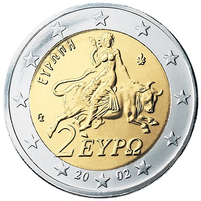
Our currency in the European Union is called the euro. 

One side of the coin is the same for all countries, but the other side is different for each.

Have you seen coins from other countries? Can you identify which country these coins are from?
Resultado de imagen de euro coinsç


If you have a euro coin from another country, bring it to class. I will take a picture of it and we can make a virtual collection!

This website will help you discover which country your coin is from!

martes, 18 de abril de 2017

jueves, 16 de marzo de 2017

Social Science Unit 4

We will have one last Social Science test before the holidays. It will be on Unit 4, Landforms and territories of Europe.

http://maplists.com/wp-content/uploads/detailed-physical-map-of-europe-27813651.jpg

You must know several definitions and also the map.   Locate on the map:


Mountains:  Ural, Caucasus, Scandinavian, Grampian, Alps, Carpathian, Balkan, Pyrenees, Dinaric Alps, Apennines, Massif Central
Peninsulas:  Kola, Crimean, Iberian, Balkan, Italian, Scandinavian, Jutland
Islands: Sardinia, Corsica, Sicily,  Crete, Azores, Cyprus, British Isles, Iceland. Balearic
Capes:  North, Saint Vicent, Matapan, Fisterra
Gulfs:  Bothnia, Bizkaia, Lion, Genoa
Plains.  Russian Plain, Great European Plain
Seas:  Mediterranean, Black, Caspian, Adriatic, North, Baltic, Cantabrian,Tyrrhenian.
Oceans: Atlantic, Artic
Peaks: Mont Blanc, Elbrus, Mulhacén, Aneto

Other: Strait of Gibraltar, English Channel, Asia, Africa

Map games to practice:

European Relief (What is it called?)
European Relief 2 (Where is it?)
Coasts of Europe 1 (What is it called?)
Coasts of Europe 2 (Where is it?)

The maps about the coasts have a lot of information that you don't need to memorise, but you can use the  "Mirar" feature (instead of "Jugar") to practice!

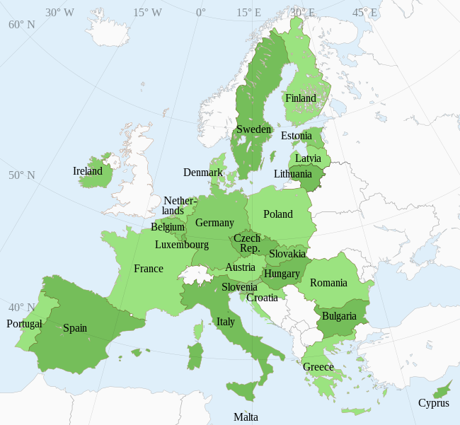
After Semana Santa we will start to learn the countries of Europe (political map!)

Here is a presentation about Physical Geography of Europe. It includes rivers and climate (which we will learn about later!)